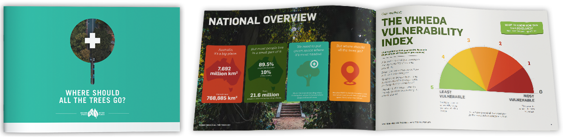
WHERE SHOULD ALL THE TREES GO?
In 2014, 202020 Vision – now Greener Spaces Better Places – published the Where Are All The Trees? report based on research undertaken by the Institute of Sustainable Futures at the University of Technology Sydney.
That was the first time that urban canopy had been benchmarked nationally.
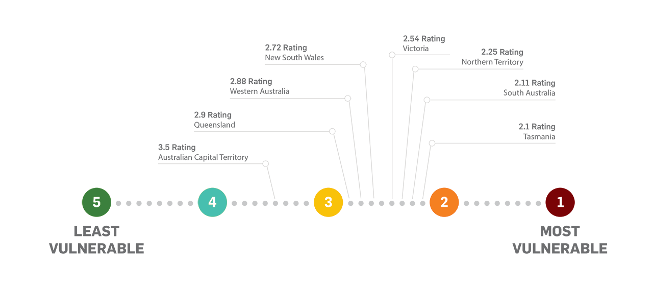
Then in 2017, RMIT and CAUL Hub researchers published a follow-up report called, Where Should All The Trees Go?. This report compared canopy levels overlaid with urban heat and socio-economic (SEIFA) data, to provided an overall vulnerability indicator. These snapshots took those findings and showed how each state rated in either their vulnerability to losing green space, or their success in creating more green space.
DOWNLOAD NOW
HOW DOES YOUR STATE RATE?
SEE HOW YOUR STATE RATES
in either their vulnerability to losing green space or their success in creating more green space
- Australian Capital Territory See the report
- New South Wales See the report
- Northern Territory See the report
- Queensland See the report
- South Australia See the report
- Tasmania See the report
- Victoria See the report
- Western Australia See the report
A key task for strategic planning of green infrastructure in large metropolitan areas will be to invest resources in planting corridors and attempting to break up patches of high heat anomalies.